

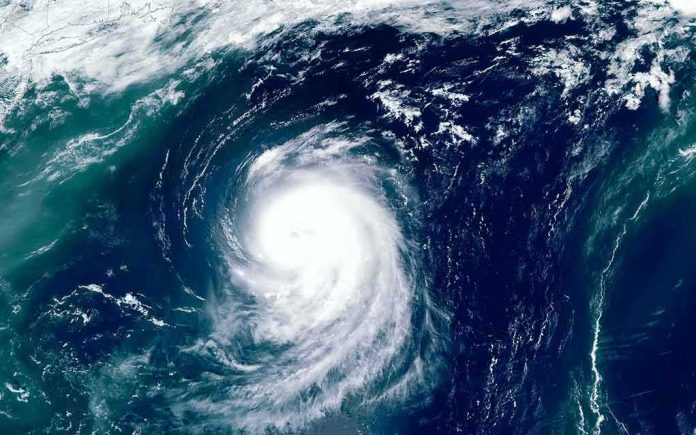
Japan’s weather agency warned that Typhoon Dujuan is set to lash eastern Japan with torrential rain, dangerous winds, and high waves during the busy Silver Week holiday.
Story Snapshot
- Japan Meteorological Agency warned of heavy rain, strong winds, and high waves for Kanto and nearby regions.
- Forecasts pointed to peak impacts from Sunday into Monday along the Pacific side, including the Tokyo area.
- Rainfall totals up to 250 millimeters were projected in a 24-hour period in some areas.
- Storm strength and track shifted across updates, but the risk message stayed clear: prepare and stay alert.
Official Guidance: What Authorities Said And When
Japan Meteorological Agency officials urged people across Kanto, the Izu Islands, and parts of Tokai and Tohoku to watch for flooding, landslides, and power outages as Typhoon Dujuan neared the region. The agency highlighted heavy rain, strong winds, and high waves as the main threats. Timing covered the Silver Week period, when travel and outdoor plans increase risk. This specific warning, issued ahead of the worst weather, aimed to push early preparation and safer choices.
Forecasts on Friday and through the weekend showed Dujuan tracking toward the Pacific side of eastern Japan, including the Tokyo area, with peak impacts from Sunday into Monday. Reporters noted the storm first moving near the Ogasawara and Izu islands, then drawing closer to Kanto. Authorities tied the expected hazards to the storm’s approach, especially for coastal zones and areas prone to flash flooding and landslides after intense rainfall.
How Strong, How Much, How Fast
Meteorologists described Dujuan’s winds near the core at about 30 meters per second, with higher gusts reported in some bulletins. Some outlets relayed that the system was assessed as a severe tropical storm by Japan’s weather agency at points, while other trackers showed brief typhoon-strength windows. These shifts are common near land as wind fields wobble and rain bands expand, but they do not reduce the risk from flooding, surf, and downed trees and power lines.
Rainfall projections called for high-impact totals in short windows. One forecast warned that up to 250 millimeters could fall in 24 hours in parts of Kanto and the Izu Islands, with similarly heavy amounts possible in nearby regions. That much rain can overwhelm drains, trigger fast flash floods, and destabilize slopes. Coastal communities also faced large waves and dangerous surf that can damage harbors and make ferries and small craft unsafe.
Why Warnings Sound Urgent Before The First Drop
Japan’s weather system is built to warn early and often. Bulletins move from five-day track maps to tighter, hourly updates as a storm nears. Messages flag likely wind, rain, surge, and wave hazards so people can act ahead of time. This model leans toward caution because the cost of late warnings is high. It makes sense during a holiday week when roads, trains, and coastal sites are crowded and small delays can turn risky fast.
🚨🇯🇵 TYHOON DUJUAN HITS JAPAN
Powerful #Typhoon Dujuan is bringing torrential #rain and strong winds across eastern Japan, with Kamakura City among the areas under heavy-rain alerts.
🌧️ Flooding and landslide risks are rising as the storm approaches the #Tokyo region.… pic.twitter.com/CXHuIiw4Og
— World_Breaking_News03 (@Breaking2003) September 21, 2026
Both storm watchers and the national agency adjusted labels as new data came in, which can feel confusing. The goal is not to scare, but to keep risk top of mind while the track and strength change. Travelers and residents do not need every technical detail. They do need clear steps: stay off breakwaters, avoid mountain roads during peak rain, check local alerts often, and plan for delays or cancellations if winds or floods rise quickly.
Sources:
stripes.com, accuweather.com, japantimes.co.jp, nationthailand.com, jwa.or.jp