
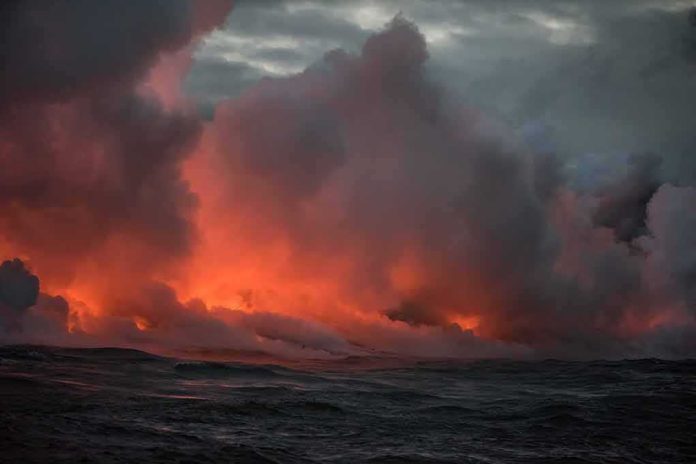
Indonesia raised Anak Krakatau’s alert to Level III after dozens of eruptions sent ash skyward and glowing lava from the crater.
Story Highlights
- Officials reported repeated eruptions in July and August and kept a strict hazard zone in place.
- Geological leaders said magma was moving toward the surface, prompting an alert raise to Level III.
- Satellite and agency reports confirmed ash plumes and ongoing unrest at the volcano.
- Authorities told the public and tourists to stay several kilometers from the active crater.
What Officials Reported About The Eruptions
Indonesia’s Geological Agency and its observation posts recorded bursts at Anak Krakatau through June, July, and August 2026. Reports logged 19 eruptions in June and July, followed by eight more on August 16 and at least six on August 24. Ash columns reached a few hundred meters above the peak, and observers saw glowing lava during several events. These reports match a pattern of short, repeat blasts rather than one giant outburst over the Sunda Strait.
On July 3, agencies raised the alert level from Level II to Level III. The acting head of the Geological Agency explained that fresh magma was moving up, and instruments showed more volcanic quakes and surface change. That combination often marks a higher risk phase. Level III is the second-highest tier in Indonesia’s four-step system, and it triggers tighter limits near the crater.
Safety Rules And The Exclusion Zone
Officials told residents, tourists, fishermen, and climbers to stay away from the active vent. Guidance warned people not to approach within several kilometers of the crater while Level III remained in force. These warnings aim to cut risk from sudden blasts, ash, and ejected rocks. Local and national outlets repeated the same safety radius so coastal traffic and island communities could plan and avoid danger zones during this restless period.
Satellite observations supported the on-the-ground reports. A European Earth observation note described ash emissions and confirmed that Indonesia raised the alert on July 2 amid increased activity. Space-based views help track plume direction and height when clouds, night, or distance block a clear line of sight from boats and coasts. This adds another layer of evidence that the unrest was persistent, not a one-off puff.
Sorting Signal From Hype In A Volcanic News Cycle
Multiple independent outlets in Indonesia and the region covered the August eruptions and the continuing Level III status. Their stories echoed the official counts and the safety steps. This kind of steady drumbeat can feel routine, yet it matters for people living and working near busy sea lanes. The facts here are solid on ash, eruption counts, and alerts. Claims about loud sounds carrying extreme distances were not part of these official write-ups.
#Krakatoa: The Eruption of Anak Krakatau continues with ash emissions rising up to 50k ft (15.2km). pic.twitter.com/fAujVA02qb
— Artanis (@Artanis04) September 5, 2026
One more caution comes from media literacy. Fact-checkers flagged at least one viral clip as computer-generated, even as they confirmed Anak Krakatau did erupt in early July. That mix of real hazard and fake visuals can confuse the public. It also shows why named agency statements, observation logs, and satellite notes are the best anchors during fast-moving natural events with big historical shadows like Krakatau’s 1883 disaster.
Sources:
watchers.news, rri.co.id, cnbcindonesia.com, voi.id, bbmkg2.bmkg.go.id, eu-space.europa.eu, tempo.co, jogja.antaranews.com