

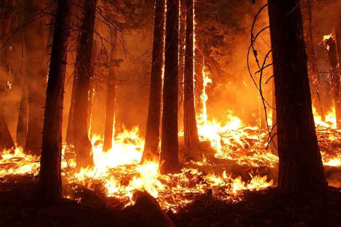
A fast-moving wildfire ignited near Yosemite’s Wawona Dome, raced through brush and timber, and forced trail closures while sparing homes and main roads, according to early official reports.
Story Highlights
- Officials reported ignition north of Wawona Dome near the Chilnualna Falls Trailhead.
- Crews attacked fast-growing flames in grass, brush, and timber fuels.
- Authorities said no immediate threat to buildings or major roads early on.
- Trail closures and shifting acre counts reflected evolving wildfire data.
What Officials Confirmed About The Dome Fire
California’s fire agency reported the Dome Fire started at 8:28 a.m. on September 15, 2026, north of Wawona Dome inside Yosemite National Park. Early updates placed the ignition point close to the Chilnualna Falls Trailhead, a popular route east of Wawona. Crews described the fire burning through grass, brush, and timber, which can drive quick spread in steep terrain. These details came as ground and air resources engaged the fire’s flanks to slow growth and protect nearby recreation areas.
Local reports through the day showed the fire’s size rising as mapping and visibility improved. One outlet cited 40 acres by midafternoon, while another later report said 100 acres by early evening. Such shifts are common in the first hours as pilots, lookouts, and incident staff refine estimates with better vantage points and tools. The key throughline stayed steady: the fire’s start area, fuels involved, and location in a rugged part of the park near Wawona Dome.
Access Limits And Safety Measures Near Wawona
Park managers moved to reduce risk to visitors by closing trails in the immediate area of the fire. The Chilnualna Falls Trail connects hikers to viewpoints and to country north of Wawona Dome, which made it a focus for temporary closures while crews worked. These steps mirror past Yosemite fire responses that keep people clear of aircraft drops, falling trees, and rolling debris while allowing firefighters to move freely on narrow paths and ridgelines.
Officials also noted that homes and developed areas faced no immediate danger in the opening phase. Highway 41 and Wawona Road remained open, easing concern for residents and travelers heading to or from the south entrance. Fire direction mattered here: reports said the blaze was burning away from Wawona, which limited structure risk. Even so, firefighters kept engines positioned to defend assets if winds shifted or embers spotted ahead of the main front.
Why Early Numbers Change In A Wildfire
Early acreage figures often come from quick visual estimates by engine bosses, helicopter crews, or air attack supervisors. Those estimates improve once Geographic Information System specialists trace perimeters from Global Positioning System tracks or infrared flights. Federal wildfire guidance and research both explain why first-day numbers can swing: the goal is fast public information, then accuracy as better data arrives. That pattern fit the Dome Fire’s reporting curve on day one.
A wildfire exploded in Yosemite National Park Tuesday morning. The Dome Fire broke out north of Wawona Dome near the Chilnualna Falls Trailhead. The Chilnualna Falls trail, as well as the trails from the top of Chilnualna Falls toward Buena Vista and Crescent Lakes, are closed… pic.twitter.com/KCf0H4HwGQ
— California Post (@californiapost) September 16, 2026
Fire managers also balance speed and precision when they post ignition times. Dispatch logs stamp the first report, but updates can reflect when the fire was first seen, when crews arrived, or when smoke columns became visible from key lookouts. The California agency’s 8:28 a.m. start time anchored the public record, while some local outlets used rounded times in their coverage. This variance is expected and usually narrows as incident documentation is finalized.
Sources:
nypost.com, reddit.com, hikingguy.com, pmc.ncbi.nlm.nih.gov, dbfightfire.com